Projects
Select a project in the dashboard sidebar to see its details and model list.
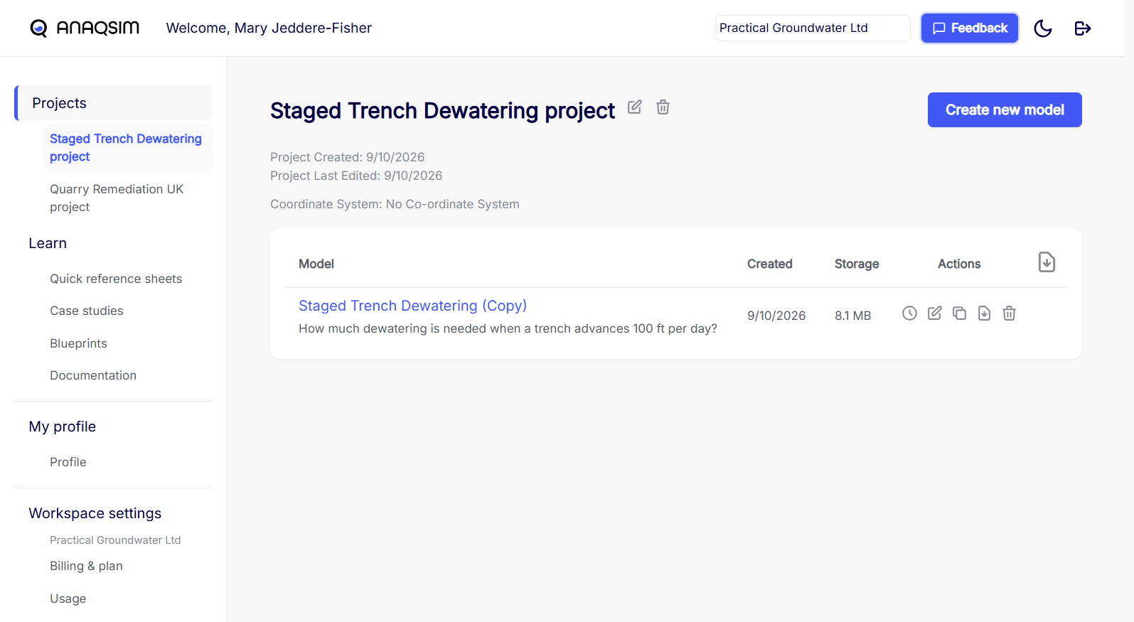
Project details
The project page shows its description, creation and last-edit dates, and coordinate system. The coordinate system applies to the models in the project. Choose No Co-ordinate System for a local Cartesian grid. Online background maps require a coordinate system.
 Edit project changes the name, description, or coordinate system.
 Delete project removes the project and its models.
Create a model
- Select Create new model.
- Enter a Name that is unique within the project. Add a Description if needed.
- To start from an existing Anaqsim input file, select Upload existing model and choose the
.anaqfile. - Select Create.
Model list
Select the model name to open the Modeling Interface. The list also shows when the model was created and how much storage it uses.
| Action | What it does |
|---|---|
 Version history |
Opens saved versions so you can restore one or save it as a new model. |
| Edit model |
Changes the model name or description. |
 Duplicate model |
Creates a copy you can edit independently. |
 Download model |
Downloads the model input file (.anaq). |
| Delete model |
Removes the model from the project. |
| Download all models |
Downloads a ZIP of the project’s .anaq files. Find this action in the table header. |
 A lock shows who has the model open for editing. If you already have it open in another tab, you can choose View only or Take over editing in the new tab. A workspace admin can release another user’s lock.